Building a New Town at Adlington presents clear and material flood risks. Large parts of the site lie in Flood zones 2 and 3 1 (areas with medium-to-high probability of river flooding), meaning the baseline risk of flooding is already elevated.

Natural Flood Defences
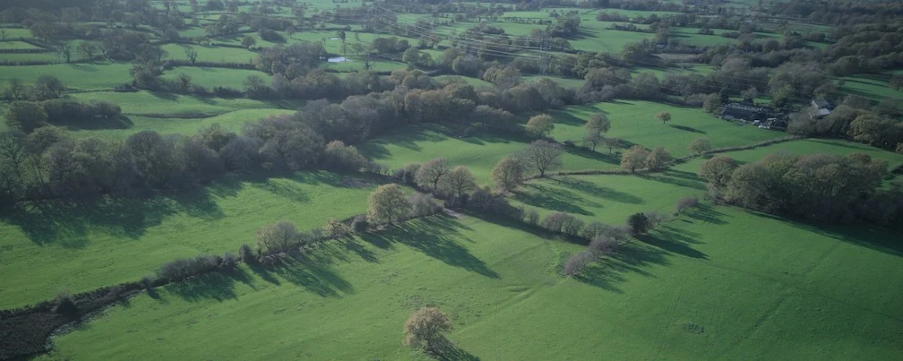
The removal of large areas of trees and vegetation and the replacement of permeable ground with roofs, roads and concrete, will significantly increase surface water runoff. Tree roots, soil and fields act as natural sponges and serve as a Natural Flood Management system 2. Mature woodland and soils slow, store and evaporate rainfall; removing thousands of trees reduces that storage capacity and accelerates the speed and peak of runoff into ordinary watercourses and rivers, raising flood peaks downstream. The cumulative effect of hard surfacing across a very large new neighbourhood would therefore tend to increase local and downstream flood frequencies. Large deciduous trees can absorb and evaporate up to 2000 litres of water per day 3.
Strategic Flood Risk Assessment
The local Strategic Flood Risk Assessment (SFRA) for Cheshire East 4 highlights that not all ordinary watercourses are hydraulically modelled and that surface water, groundwater and small watercourses can present poorly-mapped but significant risks — a reminder that flood risk for a major new development cannot be assessed only by looking at main rivers. Development on sloping land, infilling of storage areas (floodplains, wetlands) or culverting watercourses can create new pathways for floodwater and worsen problems in adjacent communities.
Impact of Climate Change
Climate change compounds these risks: planning guidance and government flood-risk services make clear that the probability and severity of river and surface-water flooding are expected to increase 5, so a site that is marginal now could become substantially higher risk across the life of the development.